
Montclair ZIP Areas
This Montclair ZIP code directory identifies two regular ZIP codes: 07042 and 07043. The first serves central and southern Montclair. The second is associated with Upper Montclair and northern Montclair. Postal coverage is not a municipal boundary, so a researcher should still check the exact address with USPS and then compare it with the parcel's tax municipality. The table preserves the 07044 caveat because route references and current postal-location results point in different directions.
| ZIP | Areas covered | Post office | Notes |
|---|---|---|---|
| 07042 | Central and southern Montclair | Montclair Post Office, 125 Glenridge Avenue, Montclair, NJ 07042, 973-873-9017 | Standard ZIP and main Montclair postal office; use USPS for exact street and ZIP+4. |
| 07043 | Upper Montclair and northern Montclair | Upper Montclair Post Office, 572 Valley Road Ste 2, Montclair, NJ 07043, 973-509-7865 | Standard ZIP with a separate station. Upper Montclair is not a separate municipality. |
| 07044 | No verified current Montclair residential coverage | Current USPS location result points to Verona, NJ 07044 | Do not treat it as a regular Montclair ZIP without address-level USPS verification. |
The USPS ZIP Lookup is the authoritative address-level check. Its result establishes a postal association for the address entered. It does not establish that a person or company is at that address.
Montclair ZIP Search Fields
USPS offers three distinct questions in one lookup service. By Address returns a ZIP for a full delivery address. By City and State returns ZIP associations for a place name. Cities by ZIP reverses that direction. These modes should not be substituted for one another. A city-and-state result can return several ZIP codes without establishing whether a specific Montclair street lies in the Township, and a ZIP-to-city result is not a person search.
| USPS mode | Required fields | Optional fields | Best use |
|---|---|---|---|
| By Address | Street, city, and state | Company, apartment, ZIP | Confirm the delivery ZIP and ZIP+4 for a precise address |
| By City & State | City and state | None captured | See ZIP associations for a postal city name |
| Cities by ZIP | ZIP | None captured | See cities associated with a ZIP |
USPS labels the button Find and advises users to narrow multiple matches with street or unit information. Save the full standardized result before proceeding to a parcel record. A ZIP code result is useful geographic evidence, but it does not prove residence.
Find Residents by Montclair ZIP
No researched Montclair source offers a public whole-ZIP browse of people. The sound process begins with a confirmed address inside the desired ZIP, then uses address-keyed public records one at a time. SDL does not document a ZIP search field. The ArcGIS viewer does not document a ZIP filter. The public voter tool checks one individual status and does not browse a ZIP. That is why a ZIP narrows geography rather than supplying a list of people.
- Use USPS By Address with the complete street, city, state, and unit when available. Confirm the postal result, but do not treat it as evidence that a person is there.
- Search the same address in the Montclair ArcGIS viewer and check its parcel geography, wards, voting districts, schools, transit, parks, and service layers.
- Confirm the tax municipality and block and lot through the address record. A parcel can be geographically close to Montclair while belonging to another municipality.
- Use the Montclair SDL portal with its address, owner, block, lot, permit, or control-number modes. A free account and valid email are required.
- If a particular person is already known and a lawful check is appropriate, use the individual New Jersey voter status tool. For street-by-street parcel and deed work after the ZIP is narrowed, use the Montclair street directory.
That sequence keeps the result tied to the exact address rather than overstating what a ZIP can reveal. It also leaves a clear record of which source answered the postal question and which one answered the parcel question.
Montclair ZIP Portal Limits
The SDL property portal is valuable after an address is known, but its documented fields are address, owner, block and lot, permit number, and control number. No ZIP-wide SDL mode was located. The ArcGIS viewer supports address search and layer browsing, but no ZIP field or filter was located. This ZIP code directory therefore uses parcel tools only after the postal address is narrowed. New Jersey's statewide parcel or Property Explorer can search by address, county, municipality, block, and lot, yet the reviewed source did not list ZIP as a filter. It also warns that owner names are redacted from hosted parcel and tax-list downloads under Daniel's Law.
| Resource | Documented search path | ZIP limitation |
|---|---|---|
| USPS ZIP Lookup | Address, city and state, or ZIP-to-city | Postal result does not confirm a person or company |
| Montclair SDL | Address, owner, block and lot, permit, control | No verified ZIP search mode |
| Montclair ArcGIS | Search by Address and map-layer browsing | No verified ZIP filter |
| NJ Property Explorer | Address, county, municipality, block, and lot | ZIP filter not located; hosted owner data redacted |
| NJ voter status | Individual status confirmation | No whole-ZIP browse |
The SDL entry screen illustrates an address-based property route, not a ZIP-based one.
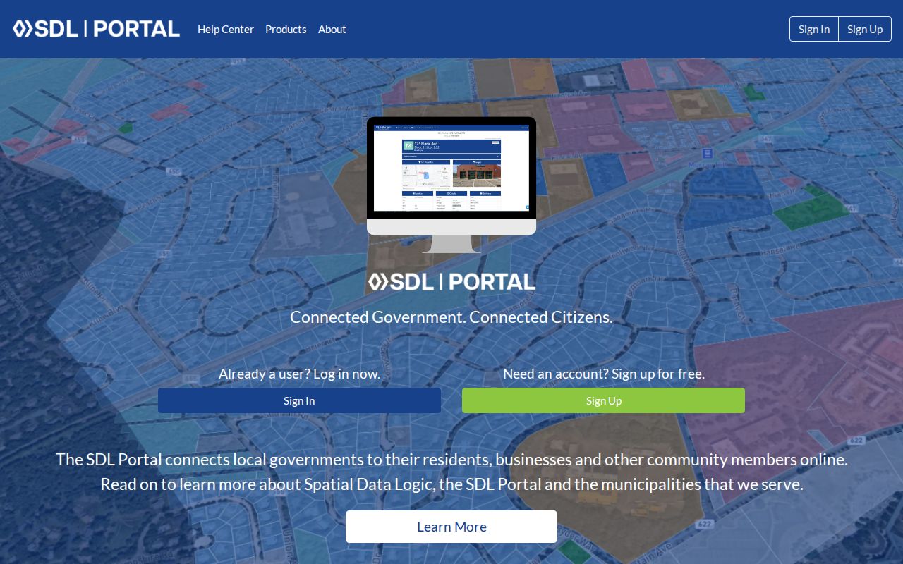
Use SDL after the postal lookup and parcel map have narrowed the address. It can connect that address to a property record, but its documented search modes do not replace USPS verification.
Note: A ZIP match, an SDL card, and a parcel map are separate records that should remain separately dated in research notes.
Montclair ZIP Boundaries and City Limits
ZIP geography and municipal geography serve different systems. Upper Montclair is a neighborhood and census-designated place within Montclair, not an independent municipality. Nearby addresses may use a Montclair mailing city or ZIP while falling outside the Township, and a Montclair-adjacent address can use Caldwell, Glen Ridge, Bloomfield, Verona, or another postal city. A ZIP code directory must therefore separate postal delivery from municipal jurisdiction. The local historical description of HackensackUMC Mountainside straddling the Montclair and Glen Ridge border shows why the GIS parcel and tax municipality must be checked alongside a postal result.
- ZIP and ZIP+4
- A ZIP is a USPS delivery geography. ZIP+4 adds a more specific delivery segment for the address.
- PO-box ZIP
- A ZIP used for post-office-box delivery rather than an ordinary street-delivery area.
- Unique ZIP
- A ZIP assigned to a single organization or facility, not a municipal boundary.
- Carrier route
- A mail-delivery route. It is not a Township or tax-boundary line.
- Tax municipality
- The local government jurisdiction used for property assessment and related records.
Montclair's Planning and GIS staff, the Assessor, and USPS are the practical contact chain for a disputed or new address. The research did not identify a separate local E911 addressing office or a published readdressing project.
Montclair ZIP 07044 Verification Trap
07044 is a useful test of why a ZIP code directory cannot rely on a range label alone. USPS postal bulletins group 07042 through 07044 for some sorting and route products. Older ZIP-range references can therefore place 07044 beside Montclair. The current USPS location result for 07044 points to Verona, and no inspected official source established ordinary current Montclair residential coverage for 07044. Treat any Montclair connection to 07044 as an address-level verification task, not a standard-coverage claim.
Common misunderstanding: A ZIP returned near Montclair does not prove a person lives within the Township or that the ZIP is a regular Montclair service area. Enter the full street address in USPS, then compare the municipal parcel and tax record. This protects against confusing a postal route, a historic reference, and the local government boundary.
Montclair ZIP History in Directories
Old directories and phone books can help date a postal address, but they are historical publication evidence. Montclair city directories cover 1870 through 1969, and the documented telephone directory run is 1980 through 1997. The Montclair History Online collection and physical holdings at the Montclair Public Library and Montclair History Center are the access channels for those materials. Preserve the printed postal city and the volume year when comparing an older reference to a present USPS result.
Historical maps add another naming check. The 1850 Essex map calls present Montclair West Bloomfield and Upper Montclair Speertown. Those variants can explain an empty historical search without changing the present municipal status of the address.
Those place names also predate the ZIP system, so they should be kept in a history note rather than forced into a current postal label. The Montclair History Center catalog includes maps from 1865, 1872, 1878, 1890, 1899, 1901, 1906, 1918, 1926, 1928, 1933, and 1934. Montclair Public Library map references include 1881 and 1890 editions. A map can help translate an old name or legal description into a present street, but USPS remains the source for current deliverability. Comparing the map year, directory year, and current address result prevents an old printed postal form from being treated as a present boundary.
Note: A directory or phone-book entry records what was printed for its edition, not a current mail-delivery or resident confirmation.
Montclair ZIP Record Checks
A careful Montclair postal result has three layers: USPS for delivery geography, GIS for the parcel's map location, and the tax municipality for local jurisdiction. The deed record adds legal description when an address is old or unclear. Do not replace one layer with another. A postal city name can be helpful, yet it does not settle municipal jurisdiction or identify a person at the address.
For an address that remains uncertain, contact Montclair Planning and GIS at 973-509-4954, the Montclair Assessor at 973-509-4920, and USPS. Use a specific address, unit, and source date when asking a custodian to clarify a record. That preserves the distinction between a delivery question and a property-record question.
Boundary check. Use postal information for mail delivery and parcel or tax records for municipal facts. Protected records can be redacted under Daniel's Law or use a substitute address through the Address Confidentiality Program.